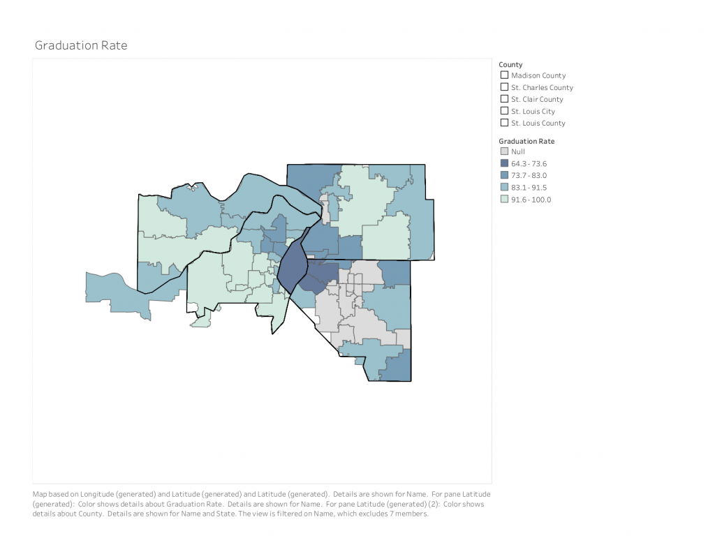
I was able to create all of the maps for Vision for Children at Risk’s data report entitled Children of Metropolitan St. Louis: A Data Book for the Community. This data book helps capture current data that measures the well-being of children in the region, and is split up by zip codes and school districts.
The entire book can be accessed here.
To note, I only created the maps for this data book, and did not design the layout of the book.